Posts Tagged ‘hiking’

I Think I’ll Lay Down in These Poppies, Poppies, Poppies

May 12, 2010

California poppy season is winding down in Southern California, as the bright orange flowers start to disappear into the landscape, weary of the warmer weather.  But if you ever find yourself in the Los Angeles area when California poppies are in peak (usually in April), the Antelope Valley California Poppy Reserve just outside of Lancaster is the place to be.  It’s about an hour out of L.A.

During the peak on a good year (like this year), as you drive toward the reserve from the south, the poppies suddenly come into view.  (The  picture below was taken traveling north toward the reserve on San Francisquito Canyon Road.)

The poppies carpet the valley floor and some hillsides with a brilliant shade of orange.  The pictures really don’t do the scenery justice.

A lot of people pull over along Lancaster Road near the poppy reserve and walk out into the flowers to take pictures.  Unfortunately, that damages the poppies for everyone else and you can get just as good of shots (without damaging the flowers) inside the park.

For $8 (or $7 if there’s a senior in the car), you can park in the park’s official lot, right by the visitor’s center.  The visitor’s center is seasonal and closed this past weekend (May 9, 2010) until next year.  It’s named after a local woman who pushed to create the poppy reserve.

Admission gets you a pamphlet that helps identify some common wildflowers.  The pamphlet includes a small trail map.

The visitor’s center has a small museum, a gift shop and restrooms.  The docents inside can tell you which trails have the best views of the poppies in the most brilliant bloom when you’re there.  Nearby, there are picnic tables, if you want to bring along lunch or a snack and eat among the poppies, poppies, poppies!  (Sorry, can’t help myself.  Too much “Wizard of Oz” and Dr. Demento as a kid.)

The trails in the park get you into the poppy fields without crushing the poppies.  At times, it really does feel like something right out of the “Wizard of Oz,” except instead of an emerald castle and flying monkeys, you get snakes and lizards.  So you probably don’t want to lay down in the flowers.  Here’s a common lizard in the area.

Rattlesnake season starts about the same time the poppies start to bloom.  So don’t be surprised if you see rattlesnakes in the park.  I didn’t see any when I was there in early April.  But if you watch out for them and don’t bother them, they generally won’t bother you.

Some of the trails in the park are accessible for wheelchairs and strollers.  Several miles worth of trails snake through the park.  You can choose whichever loop fits your fitness level.  Most of the trails are not too steep and fairly easy to walk.

One thing that’s important to note is that poppies don’t open when the sun is not out.  So you won’t get a good display on a cloudy day.   On a sunny day, they’re wide open.

The picture-taking possibilities are endless.

The sunlight plays off of the poppies, creating different shades of orange that seem to change as the day progresses.

When I was there, the poppies along the Antelope Trail North and South Loops were the most brilliant.

The South Loop of the Antelope Trail drops you into the poppy fields.

You can’t pick the wildflowers here.  No dogs allowed, either.  And there are small gnatty bugs that bite if you stand still for too long.

But definitely bring a camera to capture some of California’s gold.

Poppy Reserve Wildflower Hotline (for info about the poppy bloom)    (661) 724-1180

Directions to Antelope Valley California Poppy Reserve (from Los Angeles, the scenic route):

Make your way to northbound Interstate 5.  Exit McBean Parkway.  Turn right onto McBean Parkway.  Right on Copper Hill Drive.  Left on San Francisquito Canyon Road.  (Follow this through the Angeles National Forest.  This curvy route is popular with motorcyclists on the weekend.)  Left on Elizabeth Lake Road.  Then right on Munz Ranch Road.  Munz Ranch dead-ends into Lancaster Road, where you turn left to head to the park.

Less scenic route (also from Los Angeles):

North on Interstate 5.  North on Highway 14.  Exit Avenue I.  Turn left onto Avenue I.  The road eventually will make a jog.  Stay to the right.  Avenue I turns into Lancaster Road.

Park Hours:  Sunrise to sunset (Visitor Center only open during peak poppy season.  Closed for 2010 as of May 9.  You can still enter the park on your own, though.)

Peak Season:  Usually around April.  Poppy Festival is in late April and tends to be the most crowded weekend at the park.  You can check the reserve website for the latest pictures to see if it’s worth your time to make the drive out.

Parking Fees
$8 per vehicle
$7 per vehicle with a senior on board (62 and over)
$4 per vehicle with DPR Disabled Discount Card

K-12 school groups get in free if they contact park officials ahead of time.

Orange County, All Green (and Yellow and Purple)…

March 8, 2010

A little break from Maine today.  (We’ll go back to more Maine stuff.  I promise!)…

Today, spring has arrived in Southern California.  (Well, not OFFICIALLY.  But in California, we do things on our own time.)

The green hillsides of Orange County (south of Los Angeles) are painted with dots of blue and yellow.  Birds busy themselves with making nests.  Bees bounce from flower to flower, like famished foodies hitting the buffet line in Vegas.

My journalist friend, Jennifer Bauman, has been out and about, hiking in areas where wildflowers are just starting to come up.  It’s supposed to be a pretty awesome year for wildflowers in Southern California.  Heat followed lots of rain.  Flowers love that.  Jennifer will be writing about her hikes for the Orange County Local News Network.  The first installment of the series hits Aliso and Wood Canyons Wilderness Park in Laguna Niguel.

Bookmark and Share

Maine… Popping in for Popovers at Jordan Pond House

March 5, 2010

Pull off Acadia National Park’s loop road at the Jordan Pond House and you might find a packed parking lot and tour buses.  Don’t let that scare you.  If you’re patient, you’ll find a space.  It’s worth it.  

The Jordan Pond House is a “two-fer” stop — one for your stomach and two for your eyes.  It’s famous for its popovers, which are served warm.  (If you order two, for instance, they’ll bring you one hot popover and wait until you’re finished before bringing the second one, so that’s hot, too.)  

If you’ve never had a popover, you’re missing out!  Open it up.  (They puff up and are hollow inside.)  Slop on some butter.  Pile on some strawberry jam.  And you have yourself a hot, buttery, sweet treat.  (Be warned!  It’s been months and I still crave them.  I’ve been considering buying a popover pan and trying one of the Jordan Pond House popover recipes that I’ve found online.  But without the view, it might not be the same.)  

The Jordan Pond House in Acadia National Park is famous for its popovers, shown here with a bowl of their tomato soup.

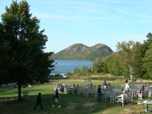
The view is awesome at the Jordan Pond House, looking over Jordan Pond, which was formed by a giant ice sheet during the last ice age.  If it’s nice out, you can eat outside on the lawn.  They day I was there, it seemed a bit chilly to sit out, even though I saw some folks with short-sleeved shirts.  (What can I say?  I’m a wimpy native Southern Californian!)  

You can eat your popovers outside on the lawn at the Jordan Pond House.

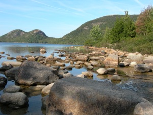
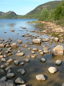
But once you’re done, there’s still some exploring to do.  Be sure to head down to the water on the short, well-marked and well-graded path down to the pond.  


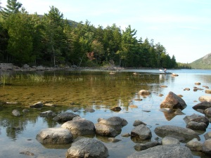
I find the rocks and reeds here to be mesmerizing.  


The water’s a bit chilly, but it would be fun to kayak.  (I did my kayaking out on the ocean, not here. )  


You can continue on and take a roughly three-mile loop around the pond.  (That hike is rated as easy on the east side with some tough sections on the west side in “A Walk in the Park: Acadia’s Hiking Guide” by Tom St. Germain.)  

I was off to see the rest of the park by car and had already taken a hike earlier in the day, so I didn’t have time to do this one.  But I’d love to come back and check it out!  

If you’ve hiked around Jordan Pond, what did you think?  Would you recommend it?  Or did you like other hikes in Acadia better?  


Bookmark and Share

Maine… Taking on Gorham Mountain

October 6, 2009

Cute seaside towns hug the Maine coast like a warm, woolly sweater during a long Maine winter.  The towns are punctuated by gorgeous seaside views, battered lobster boats and an occasional lone lighthouse.  I hit Maine this year at a time when you could have left that woolly sweater wadded up back at home.  I was lucky.  August weather in September.  Highs in the 70s and 80s.  Nearly a week of sunshine, with the leaves just starting to be kissed by fall.
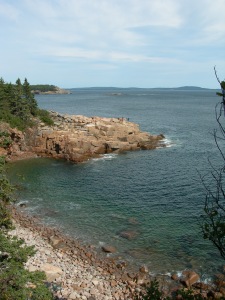
Out of Portland, about three to four hours up Highway 1, Highway 3 heads south right over a bridge and onto Mount Desert Island.  There are no bears here.  No moose either – except when a lone Bullwinkle decides to swim over for a visit.  But that’s so rare, it makes the news headlines here.  So for hikers who are on their own, it’s perfect:  forest, ocean views, solace… and no risk of being dinner on the trail.  A local B&B owner recommended my first hike:  the Gorham Mountain Trail, a moderate 4-mile loop trail on the eastern side of Acadia National Park.
Armed with water, sunscreen, mosquito repellent (which I ended up not needing) and a digital camera, I headed up the trail from the parking lot at Sand Beach in Acadia National Park.  From the lot, you cross the park loop road to get to the trail head.  It’s pretty easy to find, but it’s smart to take a trail map.  (I used “A Walk in the Park: Acadia’s Hiking Guide,” by a local hiker, Tom St. Germain.  I saw lots of people on the trail with the same pocket-sized book of trail maps and descriptions.  You can get the book at the park visitor centers or at the bookstore in town.)  From Sand Beach, the trail heads up, up, up…

maine sept 2009 (54)

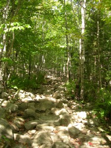
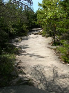
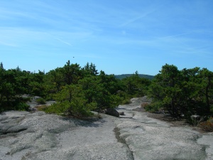
You’ll need comfortable, sturdy shoes that are good for hiking to pick your way through boulders on the trail.  But at least most of them seem solid, almost cemented in place.  The trail makes its way up the granite mountain…

maine sept 2009 (56)

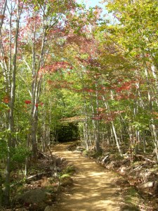
Some parts of the trail level off somewhat, through lovely forest…

Gorham Mountain Fall

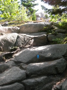
Then it’s up, up, up again.  Notice the blue paint that marks the trail.  This trail is really well marked…

Gorham Mountain 4

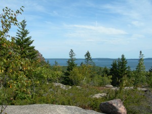
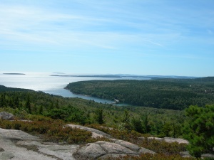
Eventually, you’re rewarded with a view of the Atlantic Ocean and neighboring islands…

Gorham Mountain 5

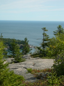
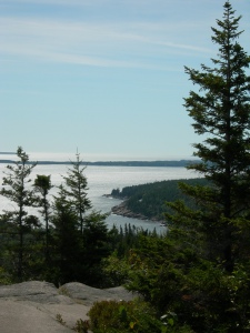
And views of Acadia’s rocky coastline…

Gorham Mountain 6

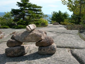
“Cairns” point the way.  (I read some of these have been around for almost 100 years.  I don’t know how true that is though.  In any event, they’re very helpful to keep you pointed in the right direction.)…

Gorham Mountain 7

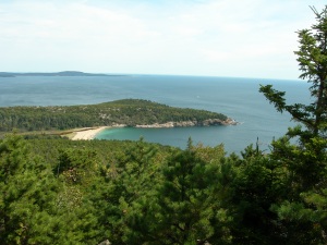
You can look back down at Sand Beach, where you came from.  (To me, the beach looks a lot like Hawaii, if Hawaii had evergreens!)…

Gorham Mountain Sand Beach

Eventually…

Gorham Granite

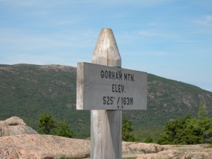
You reach the summit, complete with a marker…

Gorham Summit

On the Sunday I did this hike, there were a handful of people at the summit.  And it was super windy.  So if you’re looking for peace, quiet and no people or you’re looking to keep your hair in place, this is probably not the hike for you.  It seems to be a fairly popular trail in the park.  Another look at the view from here…

Gorham View

Time to head down the other side. (That’s a battered, borrowed copy of “A Walk in the Park” in my hand.)…

Gorham Pointing

You work your way back down toward sea level with typical Acadia National Park views along the way…

Gorham View on Way Down

Eventually you end up back down at sea level, walking back toward Sand Beach along the Ocean Path…

Ocean Path Coast

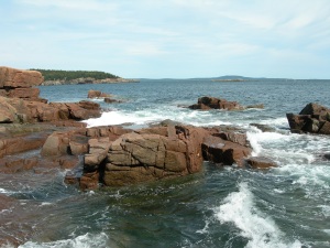
This is a flat trail, right by the one-way portion of the park loop road.  You can stop in at Thunder Hole.  (It was only gurgling when I passed.  If you hit it around high tide, the rock formation acts as a blow hole.)  Despite more people along this stretch of trail (given it’s proximity to the road), the view is pleasant.  These are some of the rocks around Thunder Hole…

Thunder Hole Rocks

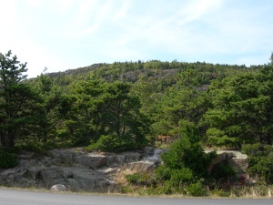
Looking up at Gorham Mountain from the Ocean Path, it doesn’t look like much…

Gorham Peak

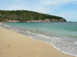
But looks can be deceiving!  Eventually, you end up back at Sand Beach…

Sand Beach

Didn’t I tell you looks can be deceiving?  Sure, it looks very tropical, but the water feels like the Arctic!  Only the brave would swim here in the Fall.  I am not one of them.  In all, a great 4-mile hike.  Took me a little more than a couple of hours at a leisurely pace.  I was able to do the entire loop road and take in other key Acadia sites for the rest of the day.

Bookmark and Share